Here are a few more video clips from Lava Rapid in the Grand Canyon. In the first one, Gene hits the very edge of the big circulating hole. We all thought he was done for, but he pulled out of it OK. Patricia in the front of the boat gets really smacked down by the waves.
In this one, David, then Carl, go through Lava.
Showing posts with label USA. Show all posts
Showing posts with label USA. Show all posts
Monday, January 12, 2009

Friday, December 19, 2008
Grand Canyon: 25 days in the rift

On the 8th of Nov, after many years on a wait list and several months of frantic preparation, Tim and I flew to Arizona for a 25 day raft trip of the Grand Canyon with our family and five people we had never met before. After meeting and unloading on the 10th, the actual river trip would begin on the 11th at Lee's ferry and end 25 days and 225 miles downstream at the Diamond Creek pull out.
That first day of setup went by in a blur of activity and confusion; unloading and pumping up boats, loading coolers, a kitchen, a Porto toilet, and all our personal gear. And then there were all the questions to be answered; who wants what boat? Where the hell is everything? How do you use and set up all this gear? And in the back of our minds, who is this handful of strangers that we will be on the river with for the next 25 days?

From left to right; Amber, Barney, Carl, Patricia, Ryan, Clint (in orange), Sandra and Yarrow (sitting), Gene (in the cowboy hat), Tim, Kimmer, Theta, Dick, and David.
We planned for an early start on the 11th, but disaster struck before sunrise! My uncle, Barney, ran into a cable in the dark and injured his back. He is not sure if he will make it or not, but we have to get down the river that day per park regulations. He spends the day laying down, well medicated, and my stepfather, David, treats him with acupuncture. Finally by midday we leave with Gene rowing Barney's boat to the closest campsite we can stay at, about six miles down river.
Fortunately, the next day Barney is starting to feel better and is ready to row the first big rapid of the river, House Rock. We reach House Rock about midway through the day and, having never been on a river like this before, I take one look at the raging current and big holes and decide that I am absolutely going to die. I grab my big sunglasses and slap them on my face to hide my tears of terror and jump into the boat with David, who has rowed the GC three times. Carl and David go through House Rock first, and then, still very much alive, we pull into the eddy to watch the others go through. Clint, with Tim in the boat, goes through pretty smooth. Then Ryan, who is rowing a big river for the first time ever, goes through and nearly gets buried in one of the holes, but manages to pull out of it OK. Barney follows last and somehow gets spun around backwards, but also pulls through. Seeing that it can actually be done, I am feeling much better now about the whole rapid thing.

Ryan in the House Rock hole.

Grabbing for the oars

Barney headed down backwards.
That evening when we pull into camp, we begin the routine that continues throughout the trip; setting up camp, dinner, and then sitting around the fire pan where Amber keeps us laughing most of the night and a competition begins between the pyromaniacs of the group to see who can pile on the most wood. In the beginning of the trip my mother, Carl, and I are the contenders, but by the end of the trip, Ryan, who according to his girlfriend, Amber, had never burned much more then one of those yuppie fire logs before, comes out as the clear winner of the title "King Pyromaniac".

Theta sitting in front of a fire that is just getting started for the night, with the wood pile behind him.
A few days into the trip we stop for our first layover day at Nankoweep where we can see the granaries left behind by the Anasazi about 900 years ago, and also hike up to the rim to see a boulder covered with petroglyphs. On this boulder is one of the most interesting Kokopellis that I have seen. We eventually have 5 or 6 layover days on the trip, all centered around hiking up beautiful side canyons or onto the rim of the canyon. All throughout the trip there was a meteor shower which made sleeping under the stars especially amazing as we watched blazes of light streak across the sky.

Little Nankoweep Kokopelli

Nankoweep Granaries
After House Rock, the rapids continued to come along along fast and furious, and every day we went through several. In one of the smaller rapids, Carl decides to play a trick on his passengers, Sandra and Theta, and jumps out of the boat with them talking away on the seat in front of him. It took them a while to notice that they were alone in the boat, and when they finally do, after doing several double takes, Theta jumps on the oars as the boat was heading for the canyon walls. He gets the boat through the waves and Carl eventually swam back to the boat and got back in.
We were lucky throughout the trip to have no flips, but three other people also ended up swimming, although not purposely like Carl. In Serpentine rapid, Ryan's boat tilted up on it's side and he was ejected from the boat. He was able to get back in quickly. My mom and David were not quite as lucky in Sapphire. My mother was sitting on top of the wood pile that they had gathered into the back of the boat for that evening's fire when David, not paying attention, took the boat through a big hole sideways and it tilted completely on its side. They were both tipped from the boat, and the entire wood pile fell on top of my mother, many pieces of which landed on her head! The boat came back down, right side up, but landed with my mom and David underneath it. Eventually they were able to get out from underneath, but while my mom was able to grab onto the boat, David was immediately sucked down into a hole. Barney watched all this from down below on the river and as the boat drifted down the river towards him he had Gene row to intersect it. At the right moment he jumped into the boat and pulled my mom back in, while David, who had eventually been spit out of the hole, swam towards the boat and, exhausted, was pulled in as well. After this near disaster, we were all a little more careful!
All too soon, the river started to mellow out again as we came closer and closer to our pull out at Diamond Creek and the end of the trip. On our second to last night came the moment we had waited for the whole trip; Bacon Bomb! Having saved our bacon grease in a metal can for the entire trip, we put the can in the fire to heat. Once it was boiling, we used another can attached to the end of a long stick to pour in some water and watch the grease explosion!
Our last night on the river, we all stayed up a little later and wished the trip could last a little longer. It was amazing to have spent so much time away from civilization, rowing and hiking and sleeping under the stars at night. It makes you realize how little we really need in life to survive and be satisfied!


Inner Granite Gorge-the oldest exposed rock in North America

On one of our hikes a few of us used a rope to get down into the narrows of Deer Creek

At Havasu, with it's blue, blue water.

David (left run) and Carl (right run) through Horn Rapid.
Monday, April 16, 2007
Mt. Whitney Mountaineer's Route trip report 4/10-4/11
The following is a very long and detailed trip report that might be useful to those planning to climb Mt. Whitney and is hopefully interesting to non-climbers as well.
I had never seen the California Sierra Nevada mountains before until we drove from Death Valley through Ridgecrest then up highway 395 to Lone Pine. When I saw the beauty of the Sierras, the climbing bug hit me again and I wondered if there was a feasible route that I might climb Mt. Whitney. At 14,497 feet (4419 meters) it is the highest mountain in the continental United States.
We went to the Interagency Visitor's Center in Lone Pine at the corner of highways 136 and 395 to talk to the rangers and research a possible climb. There is a standard route, the Mt. Whitney Trail, that starts at the 8360'/2548m trailhead at the west end of the Whitney Portal Road. The route then climbs southwest up a valley for 8.2 miles and then meets with the John Muir trail and goes north another 2.5 miles to the summit. Normally, this would be 10.7 miles and about 6100' of elevation gain. However, the Whitney Portal road that goes from Lone Pine to the trailhead was closed for winter part way up the mountain, so a longer hike would be required. I could start at the Lone Pine Campground at 5640 feet and hike 4 miles and 2720' or have Yarrow drop me off higher up the road where it is closed. Either way, the climb would be more difficult but I thought I was probably in good enough shape to climb it. I got a permit to attempt the standard route by myself in 3 days with two nights camping in the mountains.
The ranger said I would likely need crampons and an ice axe due to snow still covering parts of the trail. He referred me to Elevation, a climbing and outdoor shop in Lone Pine. I met the owner Jon and discussed my plans. He is very knowledgeable and I highly recommend his shop (Contact info: 760-876-4560, info@SierraElevation.com, www.SierraElevation.com). Since all my mountaineering gear is in storage in Denver, I rented crampons and bought an ice axe, planning to resell it after the climb. Jon recommended the Mountaineer's route instead of the Mt. Whitney Trail. This route also starts at Whitney Portal but cuts off the Mt. Whitney Trail and ascends the North Fork of Lone Pine Creek. It then passes Lower and Upper Boy Scout Lakes and Iceberg Lake. From there, the route goes up a snow filled couloir (gully), about 1200' to the right shoulder of Mt. Whitney, then turns south up another rocky gully to the summit plateau. This route sounded much more to my taste than the standard trail. It had been almost three years since I climbed a snow couloir on a high peak, and I was looking forward to doing the climb. We went back to the visitor's center and changed my permit to the new route, with 2 nights planned to camp at Iceberg Lake.
Monday night we moved to the Lone Pine Campground to escape the wind and sleep at a higher elevation closer to Whitney Portal. Yarrow fixed a lot of great food and I stuffed myself, knowing that I wouldn't be eating well on the climb. I tried to pack light, with a tarp and no tent, and cutting out any unnecessary gear, but my pack still weighed 35+ lbs. If I had a lighter pack, iodine instead of a water filter, and lighter food, I could have easily shaved 5 lbs off the total weight. When you don't have the "perfect" gear, you have to use whatever's available. I doubt I'll find an ultralight ice axe when we are in the Himalayas.
Yarrow convinced me that it would save energy and increase the chance of reaching the summit if she drove me up the road as far as possible. Tuesday morning we headed up the Whitney Portal road and she dropped me off at 6857'/2090m where we were stopped by heavy construction equipment working to clear the road. The plan was that I would meet her back at the Lone Pine Campground on Thursday. We said goodbye on the road and I started hiking at 8:45am. Only 7 miles and 7640'/2329m of elevation stood between me and the summit of the tallest mountain in the contiguous US! It would be one of my most difficult climbs and the hardest that I had attempted solo. One positive to the road closure and having to hike the extra distance was that I would be climbing in relative solitude. Starting may 1st, there is a quota limit of 160 climbers per day that start from the Whitney Portal Trailhead. I ended up seeing only 4 people during the trip.
I hiked up the road to the trailhead and noticed six vehicles that braved the road closure and were parked there. Hopefully, I'd be able to get a lift from one of them instead of hiking the extra 4 miles back down to the campground when I returned. I took a 20 min break and a blue bird with a black capped head was singing a pretty song in the tree above me. What a beautiful day with perfect weather! At 10:22, I started hiking up the Mt. Whitney Trail and soon reached the North Fork where I should turn off.
Mt. Whitney Trail goes up the left valley and the Mountaineer's Route follows the steeper North Fork valley to the right.

Here is where I made my first mistake. I did not carry a written description of the North Fork approach. Instead I drew the route on my map as I saw it in a Peter Croft Mt. Whitney guidebook. The map showed the trail starting on the south side of the creek, and that's where I found a faint trail and started hiking up the drainage. I soon saw two signs that said "Mountaineers Route" and "Entering John Muir Wilderness". I must be on the right trail, I thought. However, I soon ended up ascending a boulder field and the trail and footprints disappeared. I could not see any sign of a trail near the creek down below and the north side of the creek was all cliffs. I figured that the trail had to be on the south side. In a fit of bad routefinding judgement, I did not descend to the creek to look for a better trail. Instead, I ascended a shallow but moderately steep snow and rock gully, thinking it might be a shortcut to bypass the slabby ledges in front of me.
The gully was not as short as it first appeared and I soon realized that it was taking me up to the ridge of Mt. Thor. As the snow angle increased, I pulled out the ice axe to enhance safety. The gully must end soon, I thought, but it was very hard going, fighting snow, exposed 3rd and 4th class rock ledges, slabs and vegetation to reach the top. Several times I considered descending, but decided the easiest way must be up. My trail shoes were wet from snow and the rock was sometimes loose and crumbling. More than once I prayed that I wouldn't fall and that God would get me back to the trail safely.
Looking down the gully I incorrectly ascended

After about 300 meters of climbing, I was finally out of the gully and up on the ridge. Then I had to climb another 100m to get to a point where I could start traversing west across and down rock ledges and snowfields to reach Lower Boy Scout Lake. Finally at 2:25 I reached the lake, very tired from the effort but thanking God that I made it in one piece. The gully "shortcut" took twice as long as the correct route, and probably four times more effort. I still had more than 2 miles and 2300'/700m to reach Iceberg Lake. Tired but determined, I continued on.
View from the trail to Upper Boy Scout Lake looking up at a ridge of jagged rocks which obscure the summit of Mt. Whitney

The tracks in the snow were easy to follow for most of the rest of the route. Upper Boy Scout Lake had the last running water flowing out of its frozen eastern end, so I filled up two bottles with the water filter. I consciously tried to drink a lot of water the day before and during the climb to prevent dehydration.
I reached Iceberg Lake at 6pm and found a nice bivy site partially dug into the snow, shielded on one side by a rock wall and another by a large boulder. If you aren't familiar with the term "bivy", or bivouac, it refers to a high altitude campsite with little protection from the elements where you are lucky to get any sleep and not freeze to death. At 12,546'/3824m, with no tent and temperatures dropping below 15 deg F (-10 deg C), I had perfect bivy conditions!
Tired from climbing 6 miles and gaining over 5689'/1734m in one day, I made a second mistake. While unpacking, I tossed the gas canister on the snow and it landed upside down. Snow got into the opening that the stove screws onto. When I tried to light it to make a warm dinner and melt snow for water, it was clogged and would not light. I tried in vain to blow the snow and water out of the canister and stove jet, but soon realized that I was out of luck. With temperatures well below freezing and less than 2 liters of water left, this did not bode well. I ate nuts and cold cereal with a little water and tried to conserve the rest of the water as much as possible.
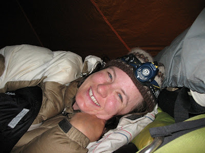
In the bivy site, I put down a plastic tarp with an inflatable ThermaRest sleeping pad on top. the bottom of the down sleeping bag I shoved into the empty backpack to keep my feet warm. The bag was rated to only 30 deg F and it got down to 10 degrees that night. Even with a silk liner I went to bed wearing all my clothes except for rain jacket. I wasn't warm that night, but I didn't freeze either. I thanked God for a safe trip and wondered what my lovely wife Yarrow was doing. She must be enjoying a campfire and some tasty food about now!
Try as I might I couldn't sleep. Once I got very painful muscle cramps in my leg, probably from dehydration. At 1am Wednesday, very light snow started to fall. I didn't want to risk the down bag getting wet, which would make it worthless, so I got up and rearranged the tarp to provide more protection. I possibly slept a little between 3 and 5 am, but it felt like I didn't sleep at all. Probably the high altitude made it hard to sleep. I noticed that my breathing was faster all night. Strangely, I wasn't preoccupied with the usual thoughts about the next morning's climb.
Is was very cold and I was camped close to the base of the climb, so I didn't get up until the sun was rising at 6am. I kept the stove, gas canister, camera and one water bottle in the sleeping bag all night to keep them from freezing. Not wanting to fool around with the stove again, I ate more nuts and a mostly frozen peanut butter and jelly sandwich.
View of Mt. Whitney and the Mountaineer's couloir at 6am

I separated out all the gear I didn't need for the summit and covered it with a tarp and rocks. I packed all the food because I didn't have a good way to protect it from rodents. I also carried some survival gear and less than a liter of water for the summit attempt. I wore long underwear and nylon pants, two polypro shirts, a down coat and wind jacket. This kept me pretty warm and I ended up removing the down coat halfway up the couloir to keep from overheating. My footwear was a little more interesting. I wore expedition weight Smartwool socks under Gore-Tex socks and tucked my pant legs into them to avoid snagging on crampons. I used 12 point Trango crampons strapped onto Garmont Nagevi trail shoes. When I returned the crampons, I learned that it goes against the manufacturer's recommendation to use these crampons on trail shoes because the sole isn't stiff enough. This setup worked fine for flat footed crampon work, but I did not attempt and would not recommend doing serious front-pointing in trail shoes. I never felt insecure in the fit between crampon and shoe, even when climbing on rock, but try this method at your own risk!
Non-traditional mountaineering footwear

I began climbing the at 6:50am while the snow and winds were increasing and the sun began to be covered with clouds. The summit was cloudy but the conditions didn't look too bad. the couloir had excellent snow for cramponing but many places it was difficult to plunge the ice axe deep for good self belays. It was moderately steep sustained climbing for 1200'/366m with some rocky sections and a maximum angle of 40 degrees. One class 3 move as required to exit the top. There is very little snow this year. Last year there was about 30' of snow at the top of this couloir instead of rock. This will probably melt out in less than a month.
View up the Mountaineer's Couloir as conditions are degrading

Just after topping out, I walked west a very short distance and turned south to go up the class 3 trough to the summit. Conditions were markedly worse there with higher winds, lower visibility and more blowing snow. Also, many of the rocks had icy sections. Here I put away the ice axe and climbed with crampons and mitten covered gloves. Several times I looked back down to make sure I could climb down safely. It is easy to climb up and get stranded if you aren't careful. The center of the trough had a very steep snowfield with many sections of blue ice. I would not have attempted that without two ice tools and stiffer boots. I traversed to the right, under the snowfield and climbed towards the summit on a rocky ridge that required some delicate and careful climbing. I was not looking forward to climbing back down it!
Looking up the last class 3 trough in poor weather conditions

I reached the summit rest house at 9:15 in "Full On Conditions", as they say in Scotland. Heavy winds driving snow 50-60mph and poor visibility.
I couldn't see the summit rest house until I was within 150 feet of it

It was bitterly cold and everything was freezing. Wind chill was below -30 degrees F. I had to breathe on the pen for a few minutes to thaw it enough to sign the summit register. I also used the pick of my axe to break through the ice inside the water bottle so I could drink.
Self portrait in the summit rest house

Summit rest house

I stayed in the summit shelter about 30 minutes to warm up, eat, and pray for a safe descent. Conditions were getting progressively worse and I was very careful descending the class 3 trough. Once, a gust of wind almost blew me off my footing near the bottom. I knew the worst was behind me when I got back to the top of the couloir. However, I had to remain vigilant and be careful about footing and planting the ice axe. The new snow that blew into the couloir was a few inches deep in places and made it harder to get the crampon points to bite into firm snow. I met two climbers, Jeff and Karen, at the base of the couloir. They had planned to climb the route but decided not to because of the weather and were surprised to see me descending it.
Jeff took this picture of me at the base of the couloir. Note how drastically the weather changed in less than 5 hours that morning!

I told them about the summit conditions and my stove problem. They offered to make me hot soup and refill my water when we reached their camp at Upper Boy Scout Lake. I got back to my bivy at 11:45am and unburied the cached gear from the snow, packed up and eventually caught up with Jeff and Karen on the slope below Iceberg Lake. the descent to Upper Boy Scout Lake was more challenging due to windy conditions and new snow. Many rocks that before had provided good footing were coated with snow, ice, and rime and very slippery. I decided to get down and out of the storm ASAP so I didn't go with them to their camp, but instead headed straight for Lower Boy Scout Lake.
At 2:25pm I reached the lake, the same time as the day before. Just before I arrived, the sun came out, the clouds blew over and the whole sky turned blue.
Lower Boy Scout Lake looking calm and clear

High peaks still showing signs of strong winds blowing snow off their summits

I pulled stuff out of my pack to dry. The stove was working again, so I made some hot tea and cooked lunch and spent two hours enjoying being out of the storm. It was still fairly cold and windy so I decided I needed to descend at least to Whitney Portal Campground. Jeff and Karen came through when I was making lunch as they had decided to go down that day. They had a car at the Portal, so I hurried to finish eating to catch up with them and hopefully get a ride. I wasn't sure if Yarrow would be back yet or not, but I was looking forward to getting to lower and warmer elevations.
I was very tired, hungry and dehydrated when I first reached the lake, but felt a lot better after the long break. I followed their tracks down the correct North Fork trail, wich was pretty easy to follow in many places. There is a 50-100 yard section that goes back and forth over the creek through ridiculously thick brush. I was sure I was off trail again but I wasn't. It could use someone to go through there with a chainsaw in a bad way.
I got a good view of the gully I accidentally climbed the day before. That poor bit of routefinding is a lesson I won't soon forget. I should have carried a written description of the approach and route to save needless pain and suffering. When I reached the main Mt. Whitney trail, I saw why I got off route from the beginning. The trail I took was the OLD trail. There is a new class 1 trail that is cleverly hidden behind boulders and sticks that goes steeply up to the north just to the right of the signs at North Fork of Lone Pine Creek. The trail is purposely hidden to keep less experienced hikers on the standard trail from accidently going up the North Fork approach. It also worked well to hide it from experienced climbers that don't know where they are going.
When you see these signs, turn right behind the boulders to reach the correct North Fork approach

I caught up with Jeff and Karen on the main trail and they offered me a ride back to Lone Pine Campground. We arrived at their car at 6:15pm. When we reached the campground I didn't see Yarrow's car but recognized a friend's van. When we pulled up next to it, there was Yarrow talking to him. I was very happy to see her! She made a campfire and an excellent dinner of pasta and fresh trout. That night I was very tired, still a bit chilled, and looking forward to a good night's sleep.
Solo climbing Mt. Whitney was a very challenging and rewarding experience. The mountain scenery was dramatic and spectacular. If the weather had been less windy I would have enjoyed spending another night up there. I learned several valuable lessons during the trip and I am thankful that I was able to summit and return safely. I am looking forward to the trekking and climbing that we'll be doing in the mountiains in Asia and South America over the next year. Mountains have a unique and sometimes harsh environment that reenergizes me spiritually, mentally and physically.
I had never seen the California Sierra Nevada mountains before until we drove from Death Valley through Ridgecrest then up highway 395 to Lone Pine. When I saw the beauty of the Sierras, the climbing bug hit me again and I wondered if there was a feasible route that I might climb Mt. Whitney. At 14,497 feet (4419 meters) it is the highest mountain in the continental United States.
We went to the Interagency Visitor's Center in Lone Pine at the corner of highways 136 and 395 to talk to the rangers and research a possible climb. There is a standard route, the Mt. Whitney Trail, that starts at the 8360'/2548m trailhead at the west end of the Whitney Portal Road. The route then climbs southwest up a valley for 8.2 miles and then meets with the John Muir trail and goes north another 2.5 miles to the summit. Normally, this would be 10.7 miles and about 6100' of elevation gain. However, the Whitney Portal road that goes from Lone Pine to the trailhead was closed for winter part way up the mountain, so a longer hike would be required. I could start at the Lone Pine Campground at 5640 feet and hike 4 miles and 2720' or have Yarrow drop me off higher up the road where it is closed. Either way, the climb would be more difficult but I thought I was probably in good enough shape to climb it. I got a permit to attempt the standard route by myself in 3 days with two nights camping in the mountains.
The ranger said I would likely need crampons and an ice axe due to snow still covering parts of the trail. He referred me to Elevation, a climbing and outdoor shop in Lone Pine. I met the owner Jon and discussed my plans. He is very knowledgeable and I highly recommend his shop (Contact info: 760-876-4560, info@SierraElevation.com, www.SierraElevation.com). Since all my mountaineering gear is in storage in Denver, I rented crampons and bought an ice axe, planning to resell it after the climb. Jon recommended the Mountaineer's route instead of the Mt. Whitney Trail. This route also starts at Whitney Portal but cuts off the Mt. Whitney Trail and ascends the North Fork of Lone Pine Creek. It then passes Lower and Upper Boy Scout Lakes and Iceberg Lake. From there, the route goes up a snow filled couloir (gully), about 1200' to the right shoulder of Mt. Whitney, then turns south up another rocky gully to the summit plateau. This route sounded much more to my taste than the standard trail. It had been almost three years since I climbed a snow couloir on a high peak, and I was looking forward to doing the climb. We went back to the visitor's center and changed my permit to the new route, with 2 nights planned to camp at Iceberg Lake.
Monday night we moved to the Lone Pine Campground to escape the wind and sleep at a higher elevation closer to Whitney Portal. Yarrow fixed a lot of great food and I stuffed myself, knowing that I wouldn't be eating well on the climb. I tried to pack light, with a tarp and no tent, and cutting out any unnecessary gear, but my pack still weighed 35+ lbs. If I had a lighter pack, iodine instead of a water filter, and lighter food, I could have easily shaved 5 lbs off the total weight. When you don't have the "perfect" gear, you have to use whatever's available. I doubt I'll find an ultralight ice axe when we are in the Himalayas.
Yarrow convinced me that it would save energy and increase the chance of reaching the summit if she drove me up the road as far as possible. Tuesday morning we headed up the Whitney Portal road and she dropped me off at 6857'/2090m where we were stopped by heavy construction equipment working to clear the road. The plan was that I would meet her back at the Lone Pine Campground on Thursday. We said goodbye on the road and I started hiking at 8:45am. Only 7 miles and 7640'/2329m of elevation stood between me and the summit of the tallest mountain in the contiguous US! It would be one of my most difficult climbs and the hardest that I had attempted solo. One positive to the road closure and having to hike the extra distance was that I would be climbing in relative solitude. Starting may 1st, there is a quota limit of 160 climbers per day that start from the Whitney Portal Trailhead. I ended up seeing only 4 people during the trip.
I hiked up the road to the trailhead and noticed six vehicles that braved the road closure and were parked there. Hopefully, I'd be able to get a lift from one of them instead of hiking the extra 4 miles back down to the campground when I returned. I took a 20 min break and a blue bird with a black capped head was singing a pretty song in the tree above me. What a beautiful day with perfect weather! At 10:22, I started hiking up the Mt. Whitney Trail and soon reached the North Fork where I should turn off.
Mt. Whitney Trail goes up the left valley and the Mountaineer's Route follows the steeper North Fork valley to the right.

Here is where I made my first mistake. I did not carry a written description of the North Fork approach. Instead I drew the route on my map as I saw it in a Peter Croft Mt. Whitney guidebook. The map showed the trail starting on the south side of the creek, and that's where I found a faint trail and started hiking up the drainage. I soon saw two signs that said "Mountaineers Route" and "Entering John Muir Wilderness". I must be on the right trail, I thought. However, I soon ended up ascending a boulder field and the trail and footprints disappeared. I could not see any sign of a trail near the creek down below and the north side of the creek was all cliffs. I figured that the trail had to be on the south side. In a fit of bad routefinding judgement, I did not descend to the creek to look for a better trail. Instead, I ascended a shallow but moderately steep snow and rock gully, thinking it might be a shortcut to bypass the slabby ledges in front of me.
The gully was not as short as it first appeared and I soon realized that it was taking me up to the ridge of Mt. Thor. As the snow angle increased, I pulled out the ice axe to enhance safety. The gully must end soon, I thought, but it was very hard going, fighting snow, exposed 3rd and 4th class rock ledges, slabs and vegetation to reach the top. Several times I considered descending, but decided the easiest way must be up. My trail shoes were wet from snow and the rock was sometimes loose and crumbling. More than once I prayed that I wouldn't fall and that God would get me back to the trail safely.
Looking down the gully I incorrectly ascended

After about 300 meters of climbing, I was finally out of the gully and up on the ridge. Then I had to climb another 100m to get to a point where I could start traversing west across and down rock ledges and snowfields to reach Lower Boy Scout Lake. Finally at 2:25 I reached the lake, very tired from the effort but thanking God that I made it in one piece. The gully "shortcut" took twice as long as the correct route, and probably four times more effort. I still had more than 2 miles and 2300'/700m to reach Iceberg Lake. Tired but determined, I continued on.
View from the trail to Upper Boy Scout Lake looking up at a ridge of jagged rocks which obscure the summit of Mt. Whitney

The tracks in the snow were easy to follow for most of the rest of the route. Upper Boy Scout Lake had the last running water flowing out of its frozen eastern end, so I filled up two bottles with the water filter. I consciously tried to drink a lot of water the day before and during the climb to prevent dehydration.
I reached Iceberg Lake at 6pm and found a nice bivy site partially dug into the snow, shielded on one side by a rock wall and another by a large boulder. If you aren't familiar with the term "bivy", or bivouac, it refers to a high altitude campsite with little protection from the elements where you are lucky to get any sleep and not freeze to death. At 12,546'/3824m, with no tent and temperatures dropping below 15 deg F (-10 deg C), I had perfect bivy conditions!
Tired from climbing 6 miles and gaining over 5689'/1734m in one day, I made a second mistake. While unpacking, I tossed the gas canister on the snow and it landed upside down. Snow got into the opening that the stove screws onto. When I tried to light it to make a warm dinner and melt snow for water, it was clogged and would not light. I tried in vain to blow the snow and water out of the canister and stove jet, but soon realized that I was out of luck. With temperatures well below freezing and less than 2 liters of water left, this did not bode well. I ate nuts and cold cereal with a little water and tried to conserve the rest of the water as much as possible.
In the bivy site, I put down a plastic tarp with an inflatable ThermaRest sleeping pad on top. the bottom of the down sleeping bag I shoved into the empty backpack to keep my feet warm. The bag was rated to only 30 deg F and it got down to 10 degrees that night. Even with a silk liner I went to bed wearing all my clothes except for rain jacket. I wasn't warm that night, but I didn't freeze either. I thanked God for a safe trip and wondered what my lovely wife Yarrow was doing. She must be enjoying a campfire and some tasty food about now!
Try as I might I couldn't sleep. Once I got very painful muscle cramps in my leg, probably from dehydration. At 1am Wednesday, very light snow started to fall. I didn't want to risk the down bag getting wet, which would make it worthless, so I got up and rearranged the tarp to provide more protection. I possibly slept a little between 3 and 5 am, but it felt like I didn't sleep at all. Probably the high altitude made it hard to sleep. I noticed that my breathing was faster all night. Strangely, I wasn't preoccupied with the usual thoughts about the next morning's climb.
Is was very cold and I was camped close to the base of the climb, so I didn't get up until the sun was rising at 6am. I kept the stove, gas canister, camera and one water bottle in the sleeping bag all night to keep them from freezing. Not wanting to fool around with the stove again, I ate more nuts and a mostly frozen peanut butter and jelly sandwich.
View of Mt. Whitney and the Mountaineer's couloir at 6am

I separated out all the gear I didn't need for the summit and covered it with a tarp and rocks. I packed all the food because I didn't have a good way to protect it from rodents. I also carried some survival gear and less than a liter of water for the summit attempt. I wore long underwear and nylon pants, two polypro shirts, a down coat and wind jacket. This kept me pretty warm and I ended up removing the down coat halfway up the couloir to keep from overheating. My footwear was a little more interesting. I wore expedition weight Smartwool socks under Gore-Tex socks and tucked my pant legs into them to avoid snagging on crampons. I used 12 point Trango crampons strapped onto Garmont Nagevi trail shoes. When I returned the crampons, I learned that it goes against the manufacturer's recommendation to use these crampons on trail shoes because the sole isn't stiff enough. This setup worked fine for flat footed crampon work, but I did not attempt and would not recommend doing serious front-pointing in trail shoes. I never felt insecure in the fit between crampon and shoe, even when climbing on rock, but try this method at your own risk!
Non-traditional mountaineering footwear

I began climbing the at 6:50am while the snow and winds were increasing and the sun began to be covered with clouds. The summit was cloudy but the conditions didn't look too bad. the couloir had excellent snow for cramponing but many places it was difficult to plunge the ice axe deep for good self belays. It was moderately steep sustained climbing for 1200'/366m with some rocky sections and a maximum angle of 40 degrees. One class 3 move as required to exit the top. There is very little snow this year. Last year there was about 30' of snow at the top of this couloir instead of rock. This will probably melt out in less than a month.
View up the Mountaineer's Couloir as conditions are degrading

Just after topping out, I walked west a very short distance and turned south to go up the class 3 trough to the summit. Conditions were markedly worse there with higher winds, lower visibility and more blowing snow. Also, many of the rocks had icy sections. Here I put away the ice axe and climbed with crampons and mitten covered gloves. Several times I looked back down to make sure I could climb down safely. It is easy to climb up and get stranded if you aren't careful. The center of the trough had a very steep snowfield with many sections of blue ice. I would not have attempted that without two ice tools and stiffer boots. I traversed to the right, under the snowfield and climbed towards the summit on a rocky ridge that required some delicate and careful climbing. I was not looking forward to climbing back down it!
Looking up the last class 3 trough in poor weather conditions

I reached the summit rest house at 9:15 in "Full On Conditions", as they say in Scotland. Heavy winds driving snow 50-60mph and poor visibility.
I couldn't see the summit rest house until I was within 150 feet of it

It was bitterly cold and everything was freezing. Wind chill was below -30 degrees F. I had to breathe on the pen for a few minutes to thaw it enough to sign the summit register. I also used the pick of my axe to break through the ice inside the water bottle so I could drink.
Self portrait in the summit rest house

Summit rest house

I stayed in the summit shelter about 30 minutes to warm up, eat, and pray for a safe descent. Conditions were getting progressively worse and I was very careful descending the class 3 trough. Once, a gust of wind almost blew me off my footing near the bottom. I knew the worst was behind me when I got back to the top of the couloir. However, I had to remain vigilant and be careful about footing and planting the ice axe. The new snow that blew into the couloir was a few inches deep in places and made it harder to get the crampon points to bite into firm snow. I met two climbers, Jeff and Karen, at the base of the couloir. They had planned to climb the route but decided not to because of the weather and were surprised to see me descending it.
Jeff took this picture of me at the base of the couloir. Note how drastically the weather changed in less than 5 hours that morning!

I told them about the summit conditions and my stove problem. They offered to make me hot soup and refill my water when we reached their camp at Upper Boy Scout Lake. I got back to my bivy at 11:45am and unburied the cached gear from the snow, packed up and eventually caught up with Jeff and Karen on the slope below Iceberg Lake. the descent to Upper Boy Scout Lake was more challenging due to windy conditions and new snow. Many rocks that before had provided good footing were coated with snow, ice, and rime and very slippery. I decided to get down and out of the storm ASAP so I didn't go with them to their camp, but instead headed straight for Lower Boy Scout Lake.
At 2:25pm I reached the lake, the same time as the day before. Just before I arrived, the sun came out, the clouds blew over and the whole sky turned blue.
Lower Boy Scout Lake looking calm and clear

High peaks still showing signs of strong winds blowing snow off their summits

I pulled stuff out of my pack to dry. The stove was working again, so I made some hot tea and cooked lunch and spent two hours enjoying being out of the storm. It was still fairly cold and windy so I decided I needed to descend at least to Whitney Portal Campground. Jeff and Karen came through when I was making lunch as they had decided to go down that day. They had a car at the Portal, so I hurried to finish eating to catch up with them and hopefully get a ride. I wasn't sure if Yarrow would be back yet or not, but I was looking forward to getting to lower and warmer elevations.
I was very tired, hungry and dehydrated when I first reached the lake, but felt a lot better after the long break. I followed their tracks down the correct North Fork trail, wich was pretty easy to follow in many places. There is a 50-100 yard section that goes back and forth over the creek through ridiculously thick brush. I was sure I was off trail again but I wasn't. It could use someone to go through there with a chainsaw in a bad way.
I got a good view of the gully I accidentally climbed the day before. That poor bit of routefinding is a lesson I won't soon forget. I should have carried a written description of the approach and route to save needless pain and suffering. When I reached the main Mt. Whitney trail, I saw why I got off route from the beginning. The trail I took was the OLD trail. There is a new class 1 trail that is cleverly hidden behind boulders and sticks that goes steeply up to the north just to the right of the signs at North Fork of Lone Pine Creek. The trail is purposely hidden to keep less experienced hikers on the standard trail from accidently going up the North Fork approach. It also worked well to hide it from experienced climbers that don't know where they are going.
When you see these signs, turn right behind the boulders to reach the correct North Fork approach

I caught up with Jeff and Karen on the main trail and they offered me a ride back to Lone Pine Campground. We arrived at their car at 6:15pm. When we reached the campground I didn't see Yarrow's car but recognized a friend's van. When we pulled up next to it, there was Yarrow talking to him. I was very happy to see her! She made a campfire and an excellent dinner of pasta and fresh trout. That night I was very tired, still a bit chilled, and looking forward to a good night's sleep.
Solo climbing Mt. Whitney was a very challenging and rewarding experience. The mountain scenery was dramatic and spectacular. If the weather had been less windy I would have enjoyed spending another night up there. I learned several valuable lessons during the trip and I am thankful that I was able to summit and return safely. I am looking forward to the trekking and climbing that we'll be doing in the mountiains in Asia and South America over the next year. Mountains have a unique and sometimes harsh environment that reenergizes me spiritually, mentally and physically.
Wednesday, April 11, 2007
Mountains and Deserts
Currently we are in California, where Tim has decided to try climbing Mt. Whitney, 14,497 feet (about 4,419 meters) while I explore around the more accessible portions of the Sierra Nevada mountains. After renting crampons and buying an ice axe, Tim is attempting the Mountaineer's route on the east side of the mountain. Look for a trip report from him soon!
Mt. Whitney. Tim's route takes him up the large couloir on the right side of the photo.

We drove through the Grand Canyon, Las Vegas, and Death Valley to get here. Nevada was not what I expected, as it was full of mountains. Death Valley was amazing, with lots of mountains, very dry, and very remote. We stayed most of the time at 8000 feet to escape the heat (100'F / 37-38'C in the shade at valley bottom), and climbed Telescope peak (11,049 ft / 3,368 meters), which had fantastic views of the salt flats below and layer upon layer of mountain ranges and wide valleys.
Dry, colorful hills in Death Valley

Golfer on the salt formations!

Lowest point in the western Hemisphere

View of the badwater basin and salt formations in the previous photos from Telescope Peak, 11,331 ft. above.

A few more views from Telescope Peak


Mt. Whitney. Tim's route takes him up the large couloir on the right side of the photo.

We drove through the Grand Canyon, Las Vegas, and Death Valley to get here. Nevada was not what I expected, as it was full of mountains. Death Valley was amazing, with lots of mountains, very dry, and very remote. We stayed most of the time at 8000 feet to escape the heat (100'F / 37-38'C in the shade at valley bottom), and climbed Telescope peak (11,049 ft / 3,368 meters), which had fantastic views of the salt flats below and layer upon layer of mountain ranges and wide valleys.
Dry, colorful hills in Death Valley

Golfer on the salt formations!

Lowest point in the western Hemisphere

View of the badwater basin and salt formations in the previous photos from Telescope Peak, 11,331 ft. above.

A few more views from Telescope Peak


Monday, March 26, 2007
Utah: Rivers and Canyons
We have spent the last several weeks in Utah's Cedar Mesa area, backpacking through canyons and looking at Ancient Basketmaker and Anasazi ruins. The Basketmaker and Anasazi people lived in the four corners area about 2000 years ago until 1300 AD, when they migrated out of the canyons en mass, possibly because of drought conditions. They left behind buildings crafted of stone, wood, and mud, art panels painted or chiseled into the rock, pottery, stone weapons, baskets, grinding areas, corn cobs, and other artifacts that have been beautifully preserved because of the dry climate. The buildings and rock art can still be viewed in their original locations, but the other artifacts, with the exception of some pottery shards and corn cobs, have by now mostly been placed in museums and private collections.
In addition to our 12 day backpacking trip, we also spent 3 days river rafting in five pound inflatable pack rafts, something like an inner tube with a floor. During the 3 days, we managed to take only one dunking, about one-quarter of a mile after launching! Tim actually managed to stay in his raft, but my grandfather and I both swamped in a large hole and ended up swimming to a sand bar after desperately trying to grab all our stuff as it floated away. We only lost a water jug, which was recovered on a sand bar the next day.
Next on our itinerary, we drive to the Grand Canyon, then Las Vegas, where my grandfather flies home. Then Tim and I will try to find some adventure in California before we fly out of Los Angeles. I will probably post again while we are in California or London, towards the middle or end of April. Take care everyone!




In addition to our 12 day backpacking trip, we also spent 3 days river rafting in five pound inflatable pack rafts, something like an inner tube with a floor. During the 3 days, we managed to take only one dunking, about one-quarter of a mile after launching! Tim actually managed to stay in his raft, but my grandfather and I both swamped in a large hole and ended up swimming to a sand bar after desperately trying to grab all our stuff as it floated away. We only lost a water jug, which was recovered on a sand bar the next day.
Next on our itinerary, we drive to the Grand Canyon, then Las Vegas, where my grandfather flies home. Then Tim and I will try to find some adventure in California before we fly out of Los Angeles. I will probably post again while we are in California or London, towards the middle or end of April. Take care everyone!


Subscribe to:
Posts (Atom)